

Greenland‘s ice layers are now mapped in 3D, thanks to NASA’s Operation IceBridge. Peering into the frozen layers inside ice sheet, is like looking back in time. Watch the frozen video…
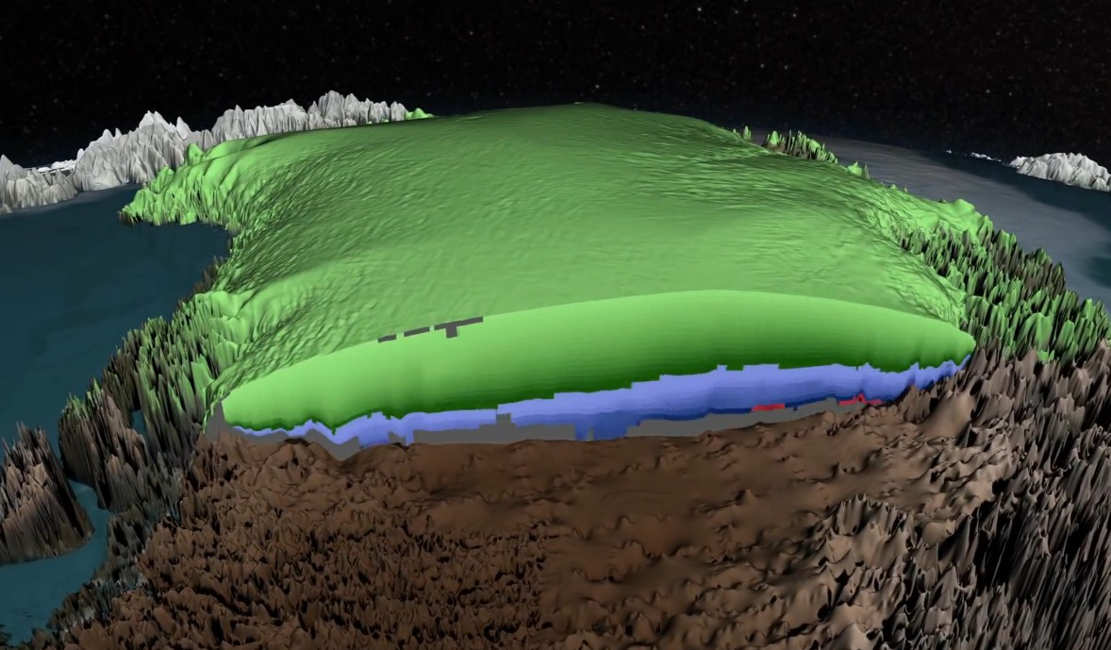
Scientists using ice-penetrating radar data collected by NASA’s Operation IceBridge and earlier airborne campaigns have built the first-ever comprehensive map of layers deep inside the Greenland Ice Sheet.
Each layer provides a record of not only snowfall and melting events, but what the Earth’s climate was like at the dawn of civilization, or during the last ice age, or during an ancient period of warmth similar to the one we are experiencing today. Using radar data from NASA’s Operation IceBridge, scientists have built the first-ever comprehensive map of the layers deep inside the ice sheet.
Scientists are interested in knowing more about ice from the Eemian period, a time from 115,000 to 130,000 years ago that was roughly as warm as today. This new age volume provides the first rough estimate of where Eemian ice may remain.

An east Greenland glacier seen from the NASA P-3 in April 2014. Credit: NASA/Jim Yungel
source NASA


Leave A Comment