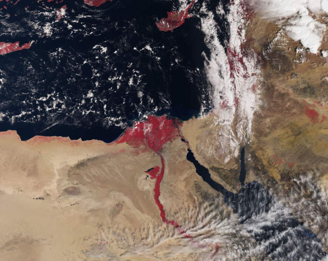
This image by new Sentinel-3A satellite, takes us over the (red) River Nile and Delta and the surrounding desert areas of northeast Africa and parts of the Middle East.
In this image, recorded on 3 March 2016, red areas indicate the presence of vegetation.
In the center of the image, capital city Cairo with the Nile snaking northwards is clearly visible, along with the Red Sea just further east. Also evident are the islands of Cyprus further north in the Mediterranean Sea and parts of Crete on the very left.
One of the suite of sophisticated instruments that will measure Earth’s oceans, land, ice and atmosphere, Sentinel-3’s Sea and Land Surface Temperature Radiometer (SLSTR) measures the energy radiating from Earth’s surface in nine spectral bands, including visible and infrared.
The instrument improves on the capabilities of the Advanced Along-Track Scanning Radiometer carried by the Envisat satellite of 2002–12, including a wider swath of 1400 km, new channels and a partly higher spatial resolution.
Image credit ESA
source ESA

Leave A Comment