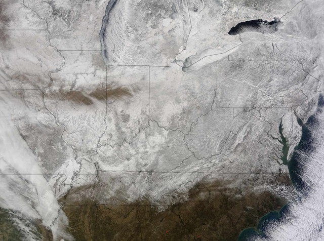
NASA’s Terra satellite captured this image of the snow-covered eastern U.S. that looks like the states have been sitting in a freezer.
Image Credit: NASA Goddard MODIS Rapid Response Team
In addition to the snow cover, Arctic and Siberian air masses have settled in over the Eastern U.S. triggering many record low temperatures in many states.
On Feb. 19 at 16:40 UTC (11:40 a.m. EST), the Moderate Resolution Imaging Spectroradiometer (MODIS) instrument that flies aboard NASA’s Terra satellite captured a picture of the snowy landscape. The snow cover combined with the frosty air mass made the eastern U.S. feel like the inside of freezer. The MODIS image was created at NASA’s Goddard Space Flight Center in Greenbelt, Maryland.
On the morning of Feb. 20, NOAA’s Weather Prediction Center (WPC) noted, “There were widespread subzero overnight lows Thursday night (Feb. 19) extending from Illinois to western Virginia, and numerous record lows were set. Bitterly-cold arctic air is setting numerous temperature records across the eastern U.S. and will keep temperatures well below normal on Friday (Feb. 20).”
Read more at NASA

Leave A Comment