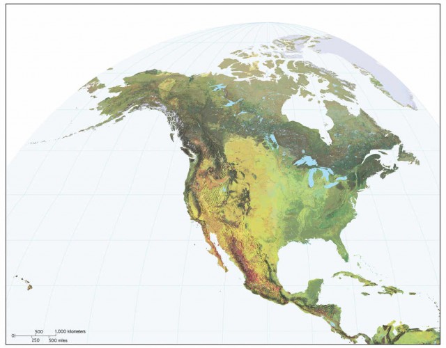
Esri and the United States Geological Survey (USGS), developed the highest spatial resolution ecological land units (ELUs) map of the world.
The Global ELUs map by Esri and the United States Geological Survey (USGS), portrays a systematic division and classification of ecological and physiographic information about land surface features.
The work was commissioned by the intergovernmental Group on Earth Observations (GEO), and published in print by the Association of American Geographers (AAG).
Roger Sayre from the USGS, said:
“This map provides, for the first time, a web-based, GIS-ready, global ecophysiographic data product for land managers, scientists, conservationists, planners, and the public to use for global and regional scale landscape analysis and accounting. The Global ELU map advances an objective, repeatable, ‘big data’ approach to the synthesis and classification of important earth surface data layers into distinct and ecologically meaningful land units.
The data will also be important to the study of environmental change. The objective and automated approach to the classification means that the mapping can be updated as better or more current input layers are created. The creation of change layers can also be automated.”
Randy Vaughan from Esri, said:
“The ecological land units also lend themselves to the study of ecological diversity, rarity and evolutionary isolation. For example we can identify the most diverse landscapes in terms of unique ecological land features. Understanding diversity can point the way to improved conservation planning.”
via wired
source Esri


Leave A Comment