Worrisome low Antarctic sea ice in the depths of winter, than scientists expected for this time of year.
Throughout July 2023, Antarctica’s sea ice averaged 13.5 million square kilometers (5.2 million square miles), the lowest extent observed for this time of year since the continuous satellite record began in late 1978.
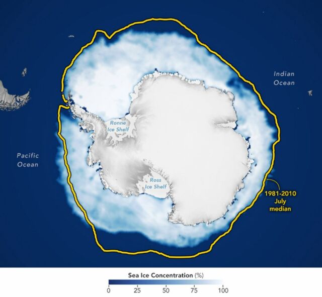
The map above shows the extent of Antarctic sea ice on August 7, 2023, based on satellite data maintained by the National Snow and Ice Data Center (NSIDC), one of NASA’s Distributed Active Archive Centers.
In July, sea ice covered about 2 million square kilometers (an area the size of Mexico) less than the 1981 to 2010 average.
The yellow line shows July’s median sea ice extent from 1981 to 2010.
The map shows ice extent was low nearly everywhere around the continent, but particularly in the northeastern Weddell Sea, northern Ross Sea, and eastern Bellingshausen Sea. The Amundsen Sea was the only area with an above-average extent.
Walt Meier, a sea ice scientist at NSIDC, said:
“What we’re seeing this year is uncharted territory in the satellite record.”
source NASA


Leave A Comment