Five wildfires, including the largest ones – the Palisades and Eaton fires – continue to burn in northern Los Angeles as of 10 January 2025.
At least 10 lives have been lost, and many properties have been destroyed.
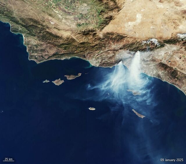
This image, taken by the Copernicus Sentinel-3 mission on 9 January 2025, shows the Palisades fire in the lower left and the Eaton fire in the upper right. Smoke from the fires stretches as far as Catalina Island and the Santa Barbara reserve to the south.
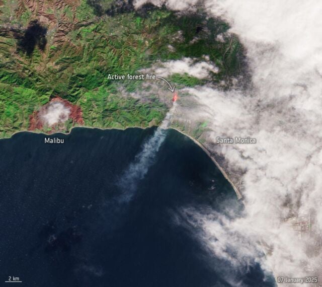
For comparison, see this image from 7 January, captured shortly after the fires began:

Copernicus Sentinel-3 monitors Earth’s oceans, land, ice, and atmosphere, delivering vital near-real-time ocean and weather forecasting data.
Credit: contains modified Copernicus Sentinel data (2025), processed by ESA


Leave A Comment