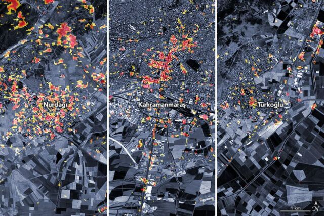
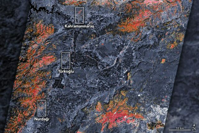
The magnitude 7.8 and 7.5 earthquakes that struck southern Türkiye and western Syria on February 6, 2023, caused widespread destruction in both countries.
The initial earthquake emanated from a fault 18 kilometers (11 miles) below the land surface. The shallow depth meant the earthquake produced violent shaking that affected areas hundreds of kilometers from the epicenter.
The first quake was followed by a 7.5 magnitude event about nine hours later, as well as hundreds of smaller aftershocks.
As news of the event spread, scientists at space agencies around the world—including NASA—began processing and analyzing satellite data relevant to the event.
“These were very large and powerful earthquakes that ruptured all the way up to the surface over a long series of fault segments,” said Eric Fielding, a geophysicist at NASA’s Jet Propulsion Laboratory. “This generated extremely strong shaking over a very large area that hit many cities and towns full of people. The rupture length and magnitude of the magnitude 7.8 earthquake was similar to the 1906 earthquake that destroyed San Francisco.”
NASA Earth Observatory images by Joshua Stevens, using Landsat data from the U.S. Geological Survey and ALOS-2 data from the Japan Aerospace Exploration Agency/JAXA and the Earth Observatory of Singapore Remote Sensing Lab. Story by Adam Voiland.
source earthobservatory


Leave A Comment