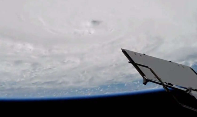
Cameras outside the International Space Station captured dramatic views of major Hurricane Matthew Oct. 3. Watch the video…
Hurricane Matthew as a Category 4, with winds of 140 miles an hour, was expected to pass over western Haiti and eastern Cuba Oct. 4 before charging north over the Bahamas Oct. 5 and potentially threatening the east coast of the United States later in the week.
Hal Pierce, of NASA’s Goddard Space Flight Center in Greenbelt, Maryland, said:
“Heaviest rain was seen well to the east of Hurricane Matthew’s center. This area of strong, convective storms has been persistent over the past few days. This area of intense rainfall is due to convergence between the trade winds (prevailing easterlies) and the wind flow from the south with Matthew. This area of heavy rainfall with Matthew may cause devastating torrential rainfall as it moves slowly over Haiti.”
source NASA


Leave A Comment