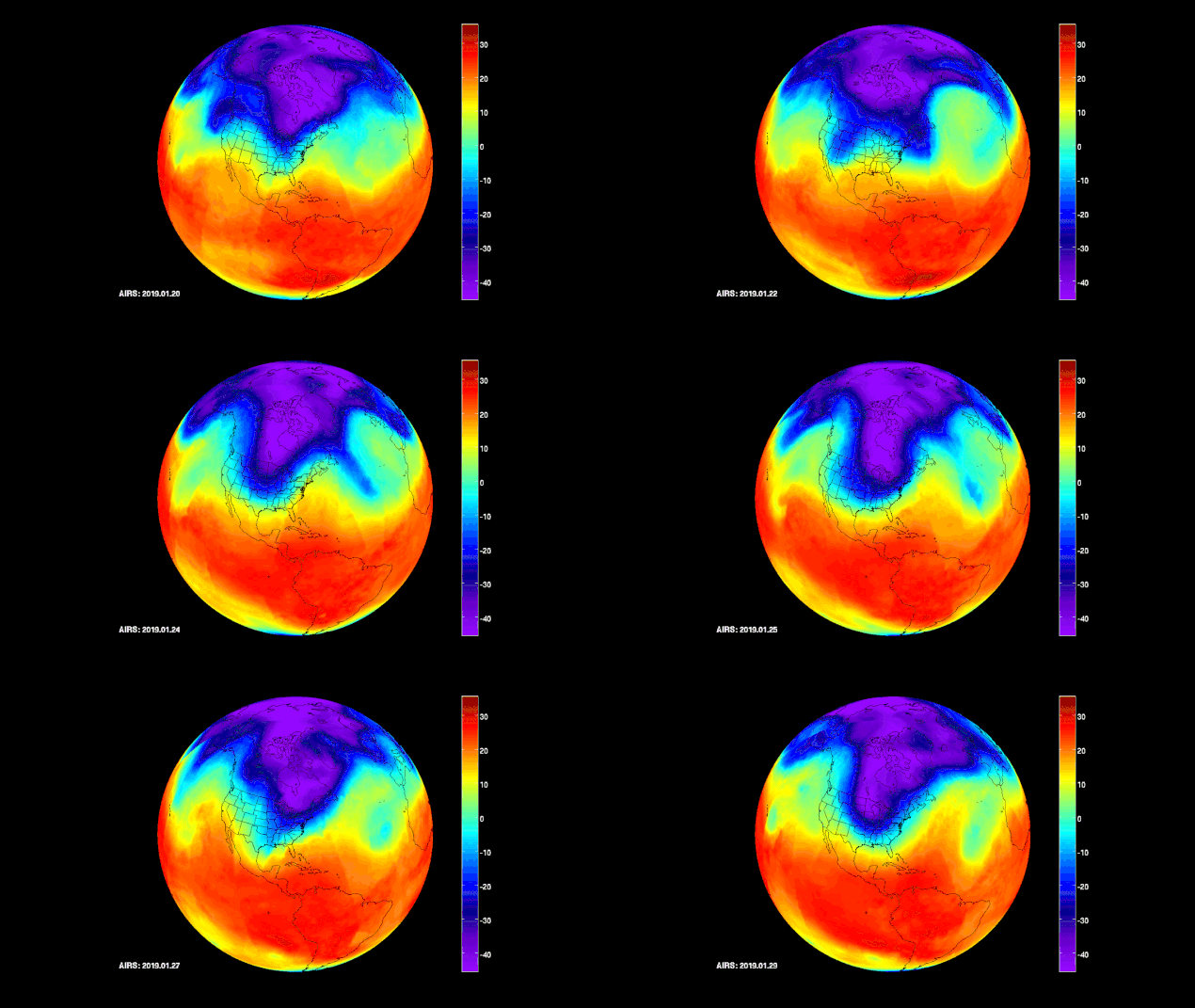
NASA’s AIRS captures Polar vortex moving in over US from January 20 through January 29.
NASA’s Atmospheric Infrared Sounder (AIRS) instrument captures a polar vortex, responsible for a number of deaths, disruptions to services, and energy outages in the affected areas, moving from Central Canada into the U.S. Midwest. The illustration shows temperatures at an altitude of about 10,000 to 15,000 feet (600 millibars atmospheric pressure) above the ground. Credit: NASA/JPL-Caltech AIRS Project
The lowest temperatures are shown in purple and blue and range from -40 degrees Fahrenheit (also -40 degrees Celsius) to -10 degrees Fahrenheit (-23 degrees Celsius). As the data series progresses, you can see how the coldest purple areas of the air mass scoop down into the U.S.
AIRS, in conjunction with the Advanced Microwave Sounding Unit (AMSU), with more than 2,000 channels sensing different regions of the atmosphere, the system creates a global, three-dimensional map of atmospheric temperature and humidity, cloud amounts and heights, greenhouse gas concentrations and many other atmospheric phenomena.
source NASA


Leave A Comment