Earth has a new Continent called Zealandia, that was hiding in plain sight.
A new study reveals that a 4.9 Mkm2 region of the southwest Pacific Ocean is made up of continental crust. Its isolation from Australia and large area support its definition as a continent—Zealandia.
The region has elevated bathymetry relative to surrounding oceanic crust, diverse and silica-rich rocks, and relatively thick and low-velocity crustal structure.
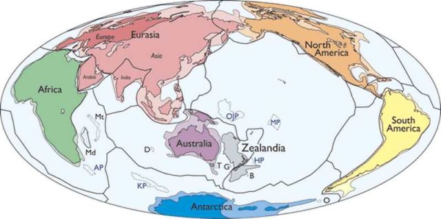
Above, simplified map of Earth’s tectonic plates and continents, including Zealandia. Continental shelf areas shown in pale colors. Large igneous province (LIP) submarine plateaus shown by blue dashed lines.
Scientists wrote in Geological Society of America journal:
“This is not a sudden discovery but a gradual realisation; as recently as 10 years ago we would not have had the accumulated data or confidence in interpretation to write this paper.”
Zealandia was formerly part of Gondwana. Today it is 94% submerged, mainly as a result of widespread Late Cretaceous crustal thinning preceding supercontinent breakup and consequent isostatic balance. The identification of Zealandia as a geological continent, rather than a collection of continental islands, fragments, and slices, more correctly represents the geology of this part of Earth. Zealandia provides a fresh context in which to investigate processes of continental rifting, thinning, and breakup.
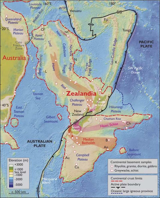
Spatial limits of Zealandia. Base map from Stagpoole (2002) based on data from Smith and Sandwell (1997). Continental basement samples from Suggate et al.
via sciencealert

In how many Millions of Years “PAST” or “FUTURE”…