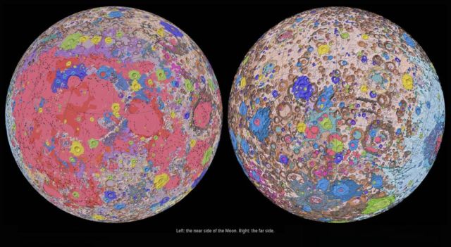
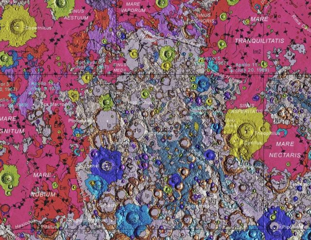
This new detailed Moon map represents a seamless, globally consistent, 1:5,000,000-scale geologic map derived from the six digitally renovated geologic maps.
The goal of this project was to create a digital resource for science research and analysis, future geologic mapping efforts, be it local-, regional-, or global-scale products, and as a resource for the educators and the public interested in lunar geology.
Here we present the completed mapping project as unit contacts, geologic unit polygons, linear features, and unit and feature nomenclature annotation. The product is overlies shaded-relief derived from SELENE Kaguya terrain camera stereo (equatorial, ~60 m/pix) and LOLA altimetry (north and south polar, 100 m/pix).
Corey Fortezzo, USGS geologist and lead author, said:
“This map is a culmination of a decades-long project. It provides vital information for new scientific studies by connecting the exploration of specific sites on the Moon with the rest of the lunar surface.”
Images credit USGS
source USGS


Leave A Comment