A 15-year-old discovers a lost Maya city in Central America, by matching stars to the location of temples on Earth.
William Gadoury, 15, by using ancient star map and studying constellations and maps of known Mayan cities, discovered the lost city.
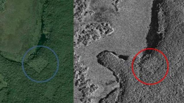
Above: Google Earth and satellite images reveal the site of an ancient pyramid. Image credit Google Earth, CSA
Gadoury explained in Le Journal de Montreal:
“I did not understand why the Maya built their cities away from rivers, on marginal lands, and in the mountains. They must have had another reason, and as they worshiped the stars, the idea came to me to verify my hypothesis. I was really surprised and excited when I realized that the most brilliant stars of the constellations matched the largest Maya cities.”
The Canadian Space Agency provided images taken from space to the young explorer, showing something like a pyramid surrounded by 30 structures, hidden under the jungle vegetation.
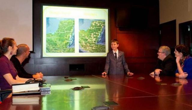
William Gadoury, 15, explains his theory. Image credit Canadian Space Agency
But Thomas Garrison, an anthropologist at USC Dornsife and an expert in remote sensing, has a different opinion on the discovery. He told Gizmodo:
I applaud the young kid’s effort and it’s exciting to see such interest in the ancient Maya and remote sensing technology in such a young person. However, ground-truthing is the key to remote sensing research. You have to be able to confirm what you are identifying in a satellite image or other type of scene. In this case, the rectilinear nature of the feature and the secondary vegetation growing back within it are clear signs of a relic milpa. I’d guess its been fallow for 10-15 years. This is obvious to anyone that has spent any time at all in the Maya lowlands. I hope that this young scholar will consider his pursuits at the university level so that his next discovery (and there are plenty to be made) will be a meaningful one.
via Gizmodo


Leave A Comment