Scientists took images of habitable planet Earth and transformed them into what alien astronomers light-years away would see.
The team led by Siteng Fan and included multiple researchers from the California Institute of Technology’s Division of Geological and Planetary Sciences (GPS) and the NASA Jet Propulsion Laboratory, started with about 10,000 images of our planet taken by NASA’s Deep Space Climate Observatory (DSCOVR) satellite.
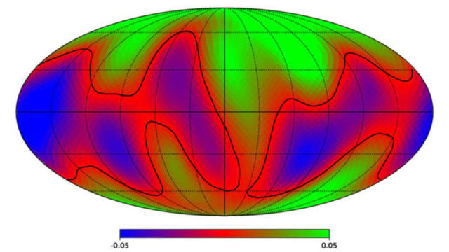
They construct a map of what Earth would look like to distant alien observers, using multi-wavelength data of Earth.
The study also will help scientists reconstruct the surface features of “Earth-like” exoplanets in the future observations.
The study titled “Earth as an Exoplanet: A Two-dimensional Alien Map,” appeared in the journal Science Mag.
Here, ~10,000 DSCOVR/EPIC frames collected over a two-year period were integrated over the Earth’s disk to yield a spectrally-dependent point source and analyzed using singular value decomposition. We found that, between the two dominant principal components (PCs), the second PC contains surface-related features of the planet, while the first PC mainly includes cloud information. We present the first two-dimensional (2D) surface map of Earth reconstructed from light curve observations without any assumptions of its spectral properties. This study serves as a baseline for reconstructing the surface features of Earth-like exoplanets in the future.
Siteng Fan told Universe Today:
“Firstly, current exoplanet studies have not figured out what the least requirements are for habitability. There are some proposed criterions, but we are not sure if they are either sufficient or necessary. Secondly, even with these criterions, current observation techniques are not good enough to confirm the habitability, especially on Earth-like exoplanets due to the difficulty of detecting and constraining them.”
sources Universe Today, arXiv


Leave A Comment