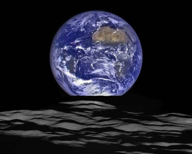
NASA releases new High-Resolution Earthrise image, recently captured from LRO spacecraft‘s vantage point in orbit around the moon.
In this composite image by NASA’s Lunar Reconnaissance Orbiter (LRO), we see Earth appear to rise over the lunar horizon from the viewpoint of the spacecraft, with the center of the Earth just off the coast of Liberia (at 4.04 degrees North, 12.44 degrees West). The large tan area in the upper right is the Sahara Desert, and just beyond is Saudi Arabia. The Atlantic and Pacific coasts of South America are visible to the left. On the moon, we get a glimpse of the crater Compton, which is located just beyond the eastern limb of the moon, on the lunar farside.
Noah Petro, Deputy Project Scientist for LRO at NASA’s Goddard Space Flight Center in Greenbelt, Maryland, said:
“The image is simply stunning. The image of the Earth evokes the famous ‘Blue Marble’ image taken by Astronaut Harrison Schmitt during Apollo 17, 43 years ago, which also showed Africa prominently in the picture.”
LRO was launched on June 18, 2009, and has collected a treasure trove of data with its seven powerful instruments, making an invaluable contribution to our knowledge about the moon. LRO experiences 12 earthrises every day; however the spacecraft is almost always busy imaging the lunar surface so only rarely does an opportunity arise such that its camera instrument can capture a view of Earth. Occasionally LRO points off into space to acquire observations of the extremely thin lunar atmosphere and perform instrument calibration measurements. During these movements sometimes Earth (and other planets) pass through the camera’s field of view and dramatic images such as the one shown here are acquired.
source NASA





Leave A Comment