You can think of the hurricane like an oversized vacuum cleaner, sucking water and heat from the surface of the ocean.
The warm, moist air is pulled up into the atmosphere, condensing into liquid as it cools in the atmosphere. Even higher up, that moisture freezes into ice. Said Michael Garay, a researcher at NASA’s Jet Propulsion Laboratory.
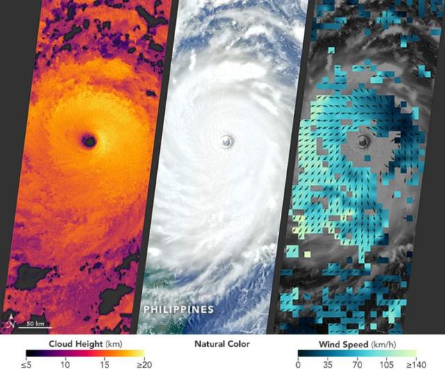
In July 2016, Super Typhoon Nepartak became first major storm of the season to make landfall in the northeast Pacific. The storm battered Taiwan with sustained winds of 113 knots (210 kilometers per hour), leaving more than 545,000 households without power. It then moved ashore in southeastern China after losing some of its strength.
As it does with many major storms, NASA monitored Nepartak from above, providing immediate data for forecasters and long-term insights for scientists who study and model tropical cyclones. Beyond natural-color imagery, satellites offer several different ways to analyze the movement of heat, wind, and water.
source NASA


Leave A Comment