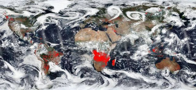
The world is on fire. Or so it appears in this image from NASA’s Worldview. The red points overlaid on the image designate those areas that by using thermal bands detect actively burning fires.
Africa seems to have the most concentrated fires. This could be due to the fact that these are most likely agricultural fires. The location, widespread nature, and number of fires suggest that these fires were deliberately set to manage land. Farmers often use fire to return nutrients to the soil and to clear the ground of unwanted plants. While fire helps enhance crops and grasses for pasture, the fires also produce smoke that degrades air quality.
Top image credit NASA Worldview, Earth Observing System Data and Information System (EOSDIS)
Elsewhere the fires, such as in North America are wildfires for the most part. In South America, specifically Chile has had horrendous numbers of wildfires this year. A study conducted by Montana State University found that: “Besides low humidity, high winds and extreme temperatures–some of the same factors contributing to fires raging across the United States–central Chile is experiencing a mega drought and large portions of its diverse native forests have been converted to more flammable tree plantations, the researchers said.”
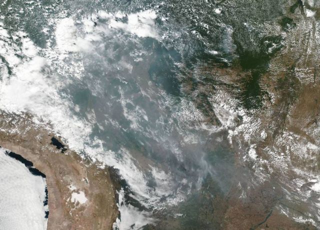
Wildfires in the Brazilian Rainforest Creating Cross Country Smoke. Credit NASA’s Earth Observing System Data and Information System (EOSDIS)
More on this study: phys.
source NASA/Goddard Space Flight Center


Leave A Comment