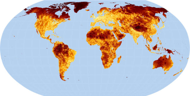
This global map indicates how long it takes to reach a city, on every place on Earth.
The global map created by scientists at the University of Oxford, backed by Bill and Melinda Gates, this travel time map shows with colors, how long it would take to get to a city from anywhere on Earth.
Above, red indicates places an hour away from a city and purple places a day or more away from a city.
The scientists hope to pinpoint and maintain world’s few remaining wilderness areas.
source The global map


Leave A Comment